


Drive autonomous public transportation forward with accurate and fast data labeling
In the fast-track world of autonomous public transportation, high-precision data labeling is the engine of safe, reliable navigation through crowded stations and tranquil tracks alike. Ensure that your vehicles, from trains to airplanes, discern every entity along their route, prioritizing passenger safety and timely arrivals.
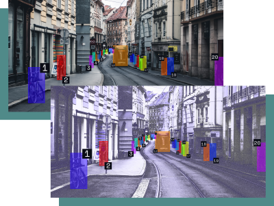
Navigate through vibrant stations and expansive transit networks, ensuring:
Consistent object ID: Maintain object IDs across various views, ensuring your ML models recognize entities consistently across their routes, from dense urban centers to serene suburbs.
Maximized efficiency: Improve time to deployment with minimized reconciliation and enhanced model accuracy.
Occlusion management: Preserve vital tracking, adeptly managing occlusions and ensuring continuous object identification.
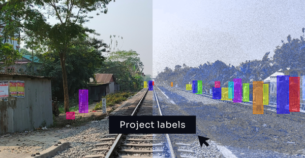
Speed up your data labeling journey through complex transit environments, by labeling multiple sensors with 1 click.
Efficient labeling: Seamlessly project 3D to 2D annotations in a single click, acquiring pre-labeled datasets for minimal adjustments.
Flexible exporting: Instance, semantic or panoptic? Export your data in multiple formats depending on your needs.

Empower your ML for autonomous public transport vehicles with the capability to navigate safely and efficiently.
Augmented labeling context: Overlay 2D and 3D sensor data, making object differentiation and labeling more precise — crucial for identifying secure pathways amid obstacles.
Smart labeling workflows: Get consistent labeling by enabling a singular annotator to overview and label all sensor data for a single sequence.
Accurate object classification: Ensure correct object classification for your project with rapid, accurate object identification across all transit routes.
Label all your sensor’s data in one interface


Label fast, accurate and efficiently with ML-assisted features build for and by machine learning teams.


